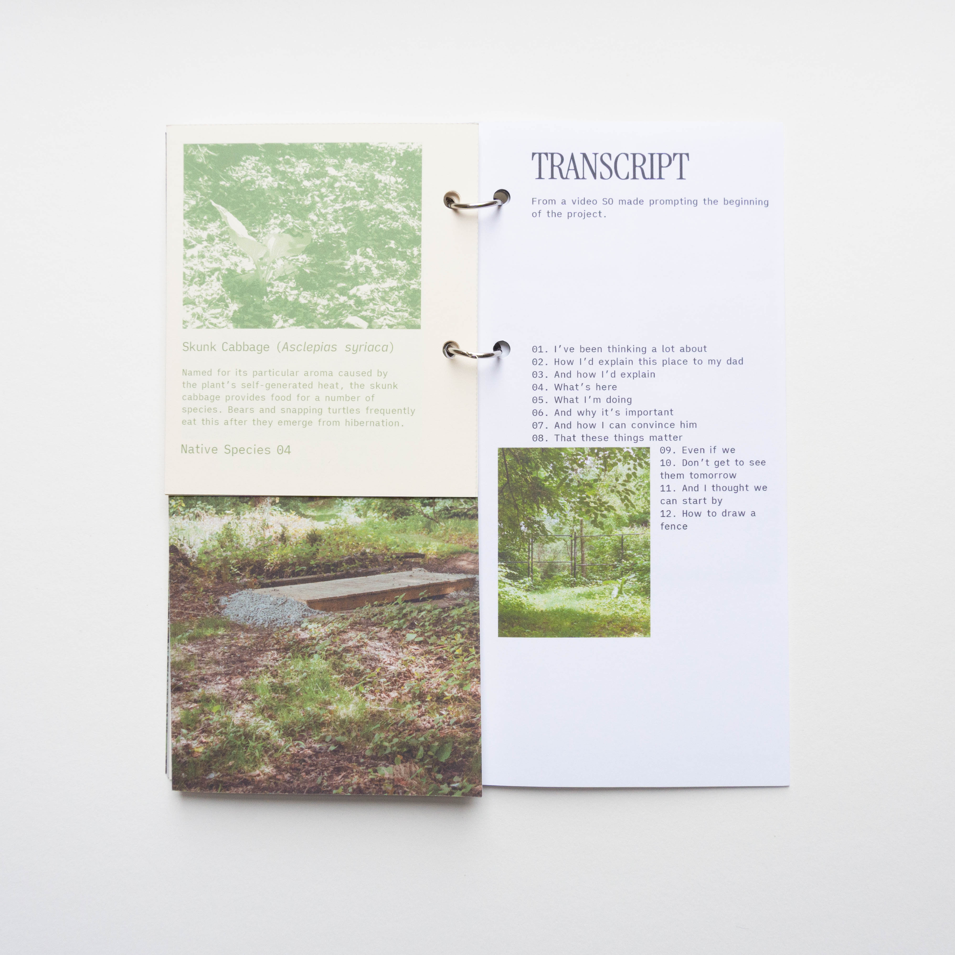
how to
draw a fence
How to Draw a Fence is a project about boundaries, and how these boundaries affect our relationship with what is on either side. Using Mariners Marsh Park as a starting point, the project reveals that boundaries are not always just "fences.” They appear as abandoned industrial sites, rows of residential houses and backyards, bodies of water, old ruins and so on. These "simple fences" are fraught with the age-old recurring conflict of man vs. nature on different scales as we determine our relationship with the environment. The project asks, how can we redraw these boundaries to start including us?
This project is made possible by a DCLA Premier Grant from Staten Island Arts, with public funding from the New York City Department of Cultural Affairs.
In addition, we’d like to thank The Puffin Foundation for their support of this project.
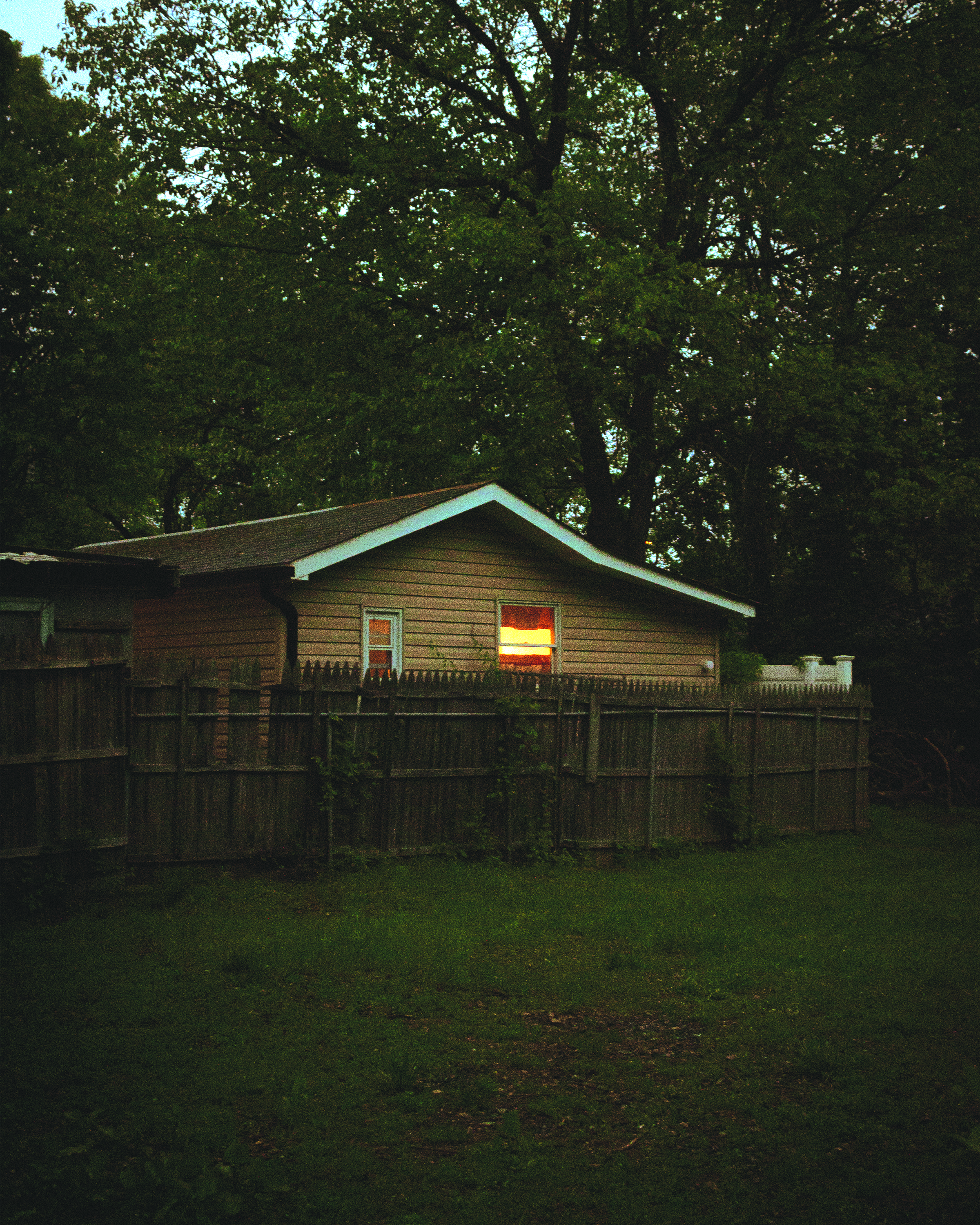
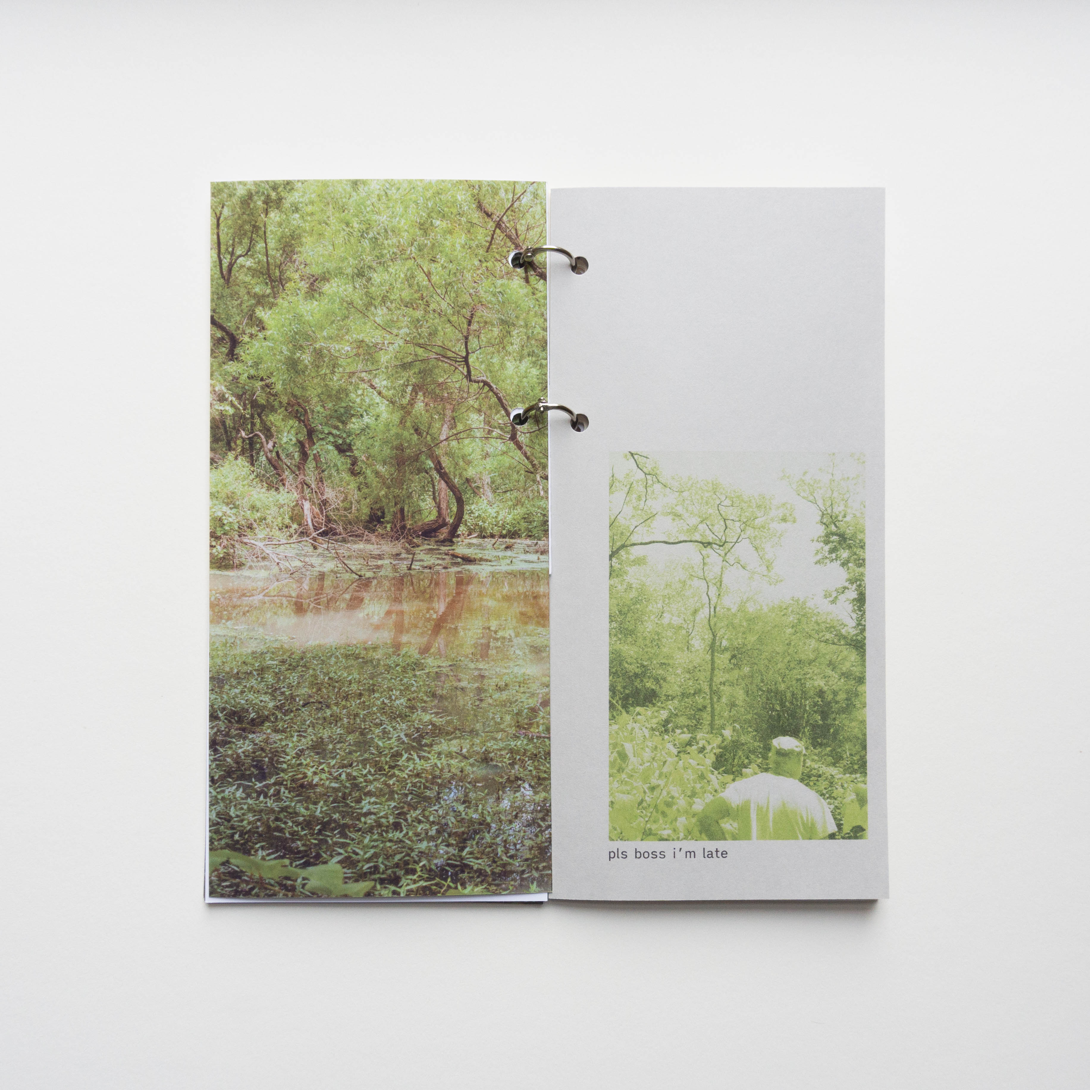
It's the early 2000's, my dad and I are leaving the movie theater at the end of Forest Avenue. It's another New York City summer—hot, sticky, and humid, with an occassional evening breeze. I'm in the rear seat of the car and we drive home with the windows rolled down. Stopped at a red light, we hear frogs.
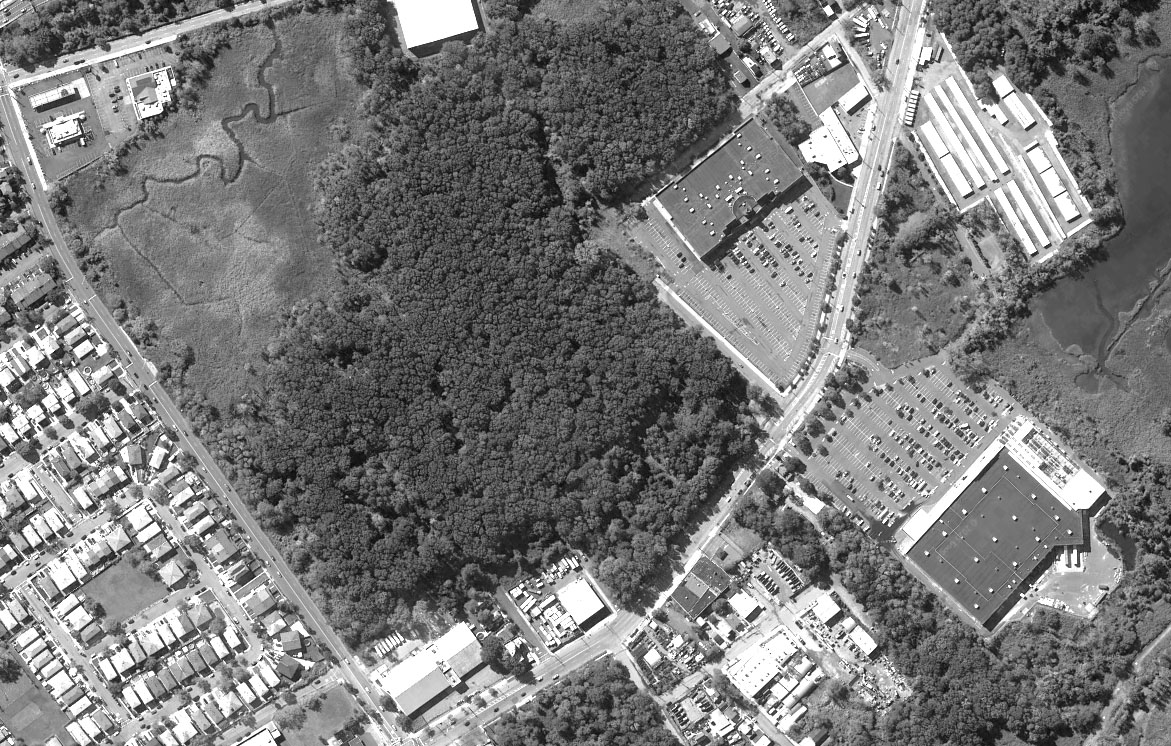 2017. Aerial Photo from Google Earth
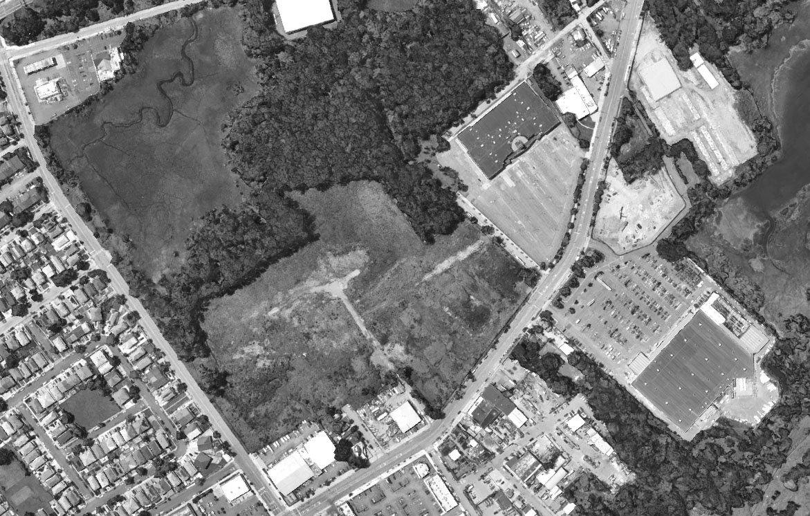 2025. Aerial Photo from Google Earth
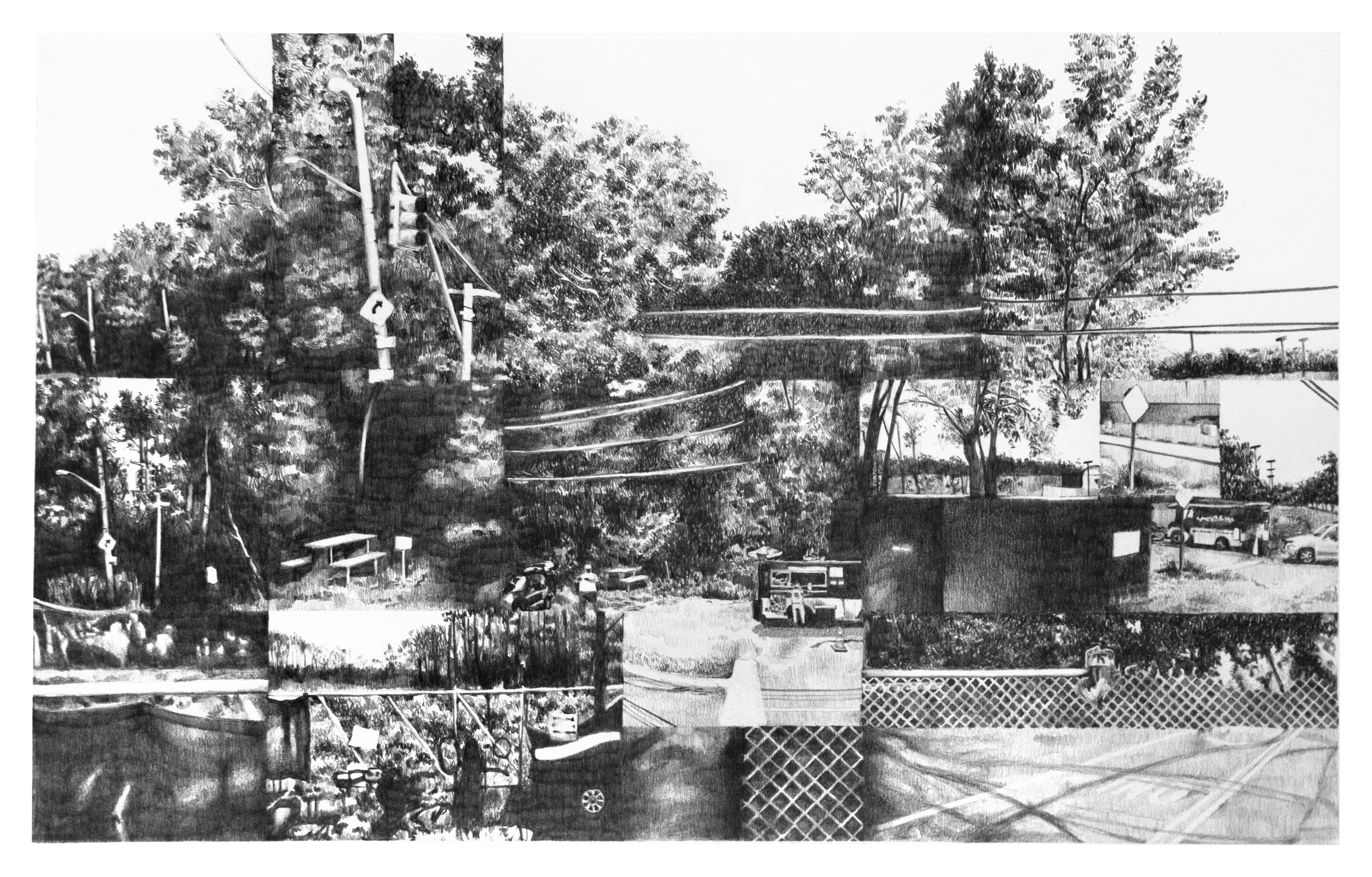
frogs in the swamp(2025)
graphite, 14in x 22in
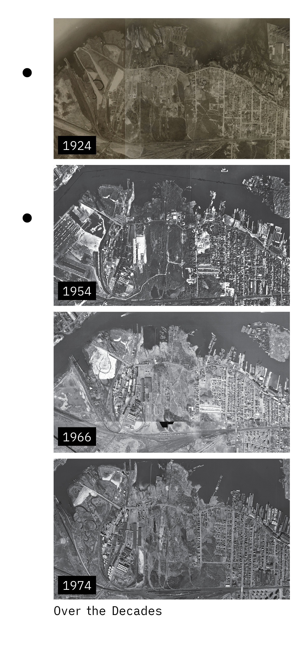
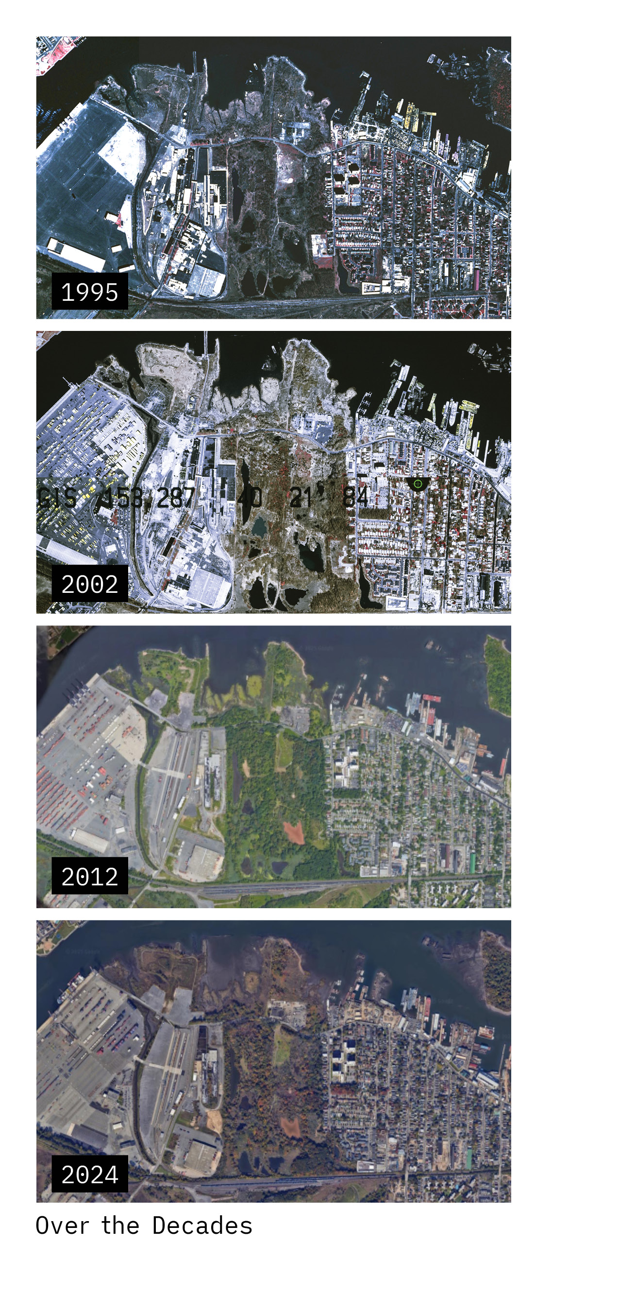
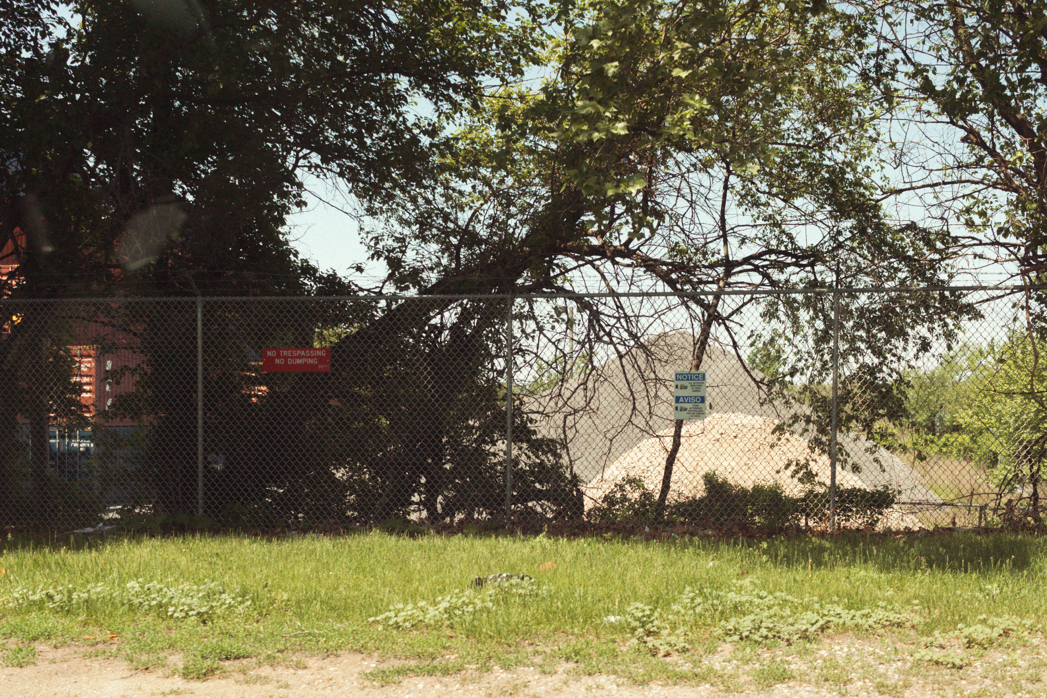
The wetlands have always been at the periphery of my summer memories, and today, the once blurry edge between the swamp and my childhood, has developed a literal fence. If not storage facilities, then industrial shipment, or other forms of ownership that are industrially privatizing the coast and turning it into a sea of grays, blacks, and fences. However, if we open Google Earth and pan all the way to Mariners Harbor, we see the bright greens and earthy browns of the wetlands.
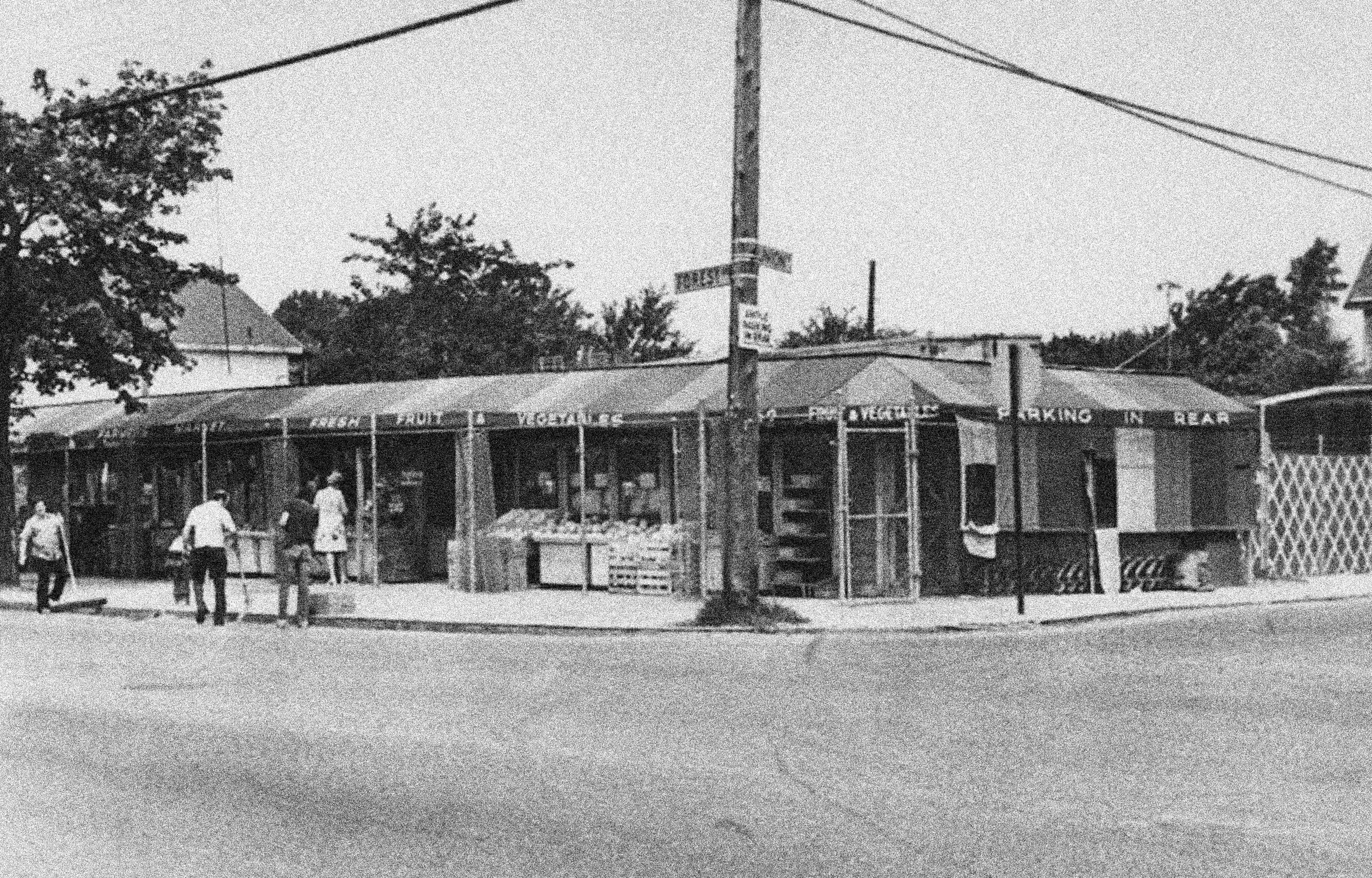 Intersection at Forest Avenue and Union Avenue (1973)
Photo by The Staten Island Advance
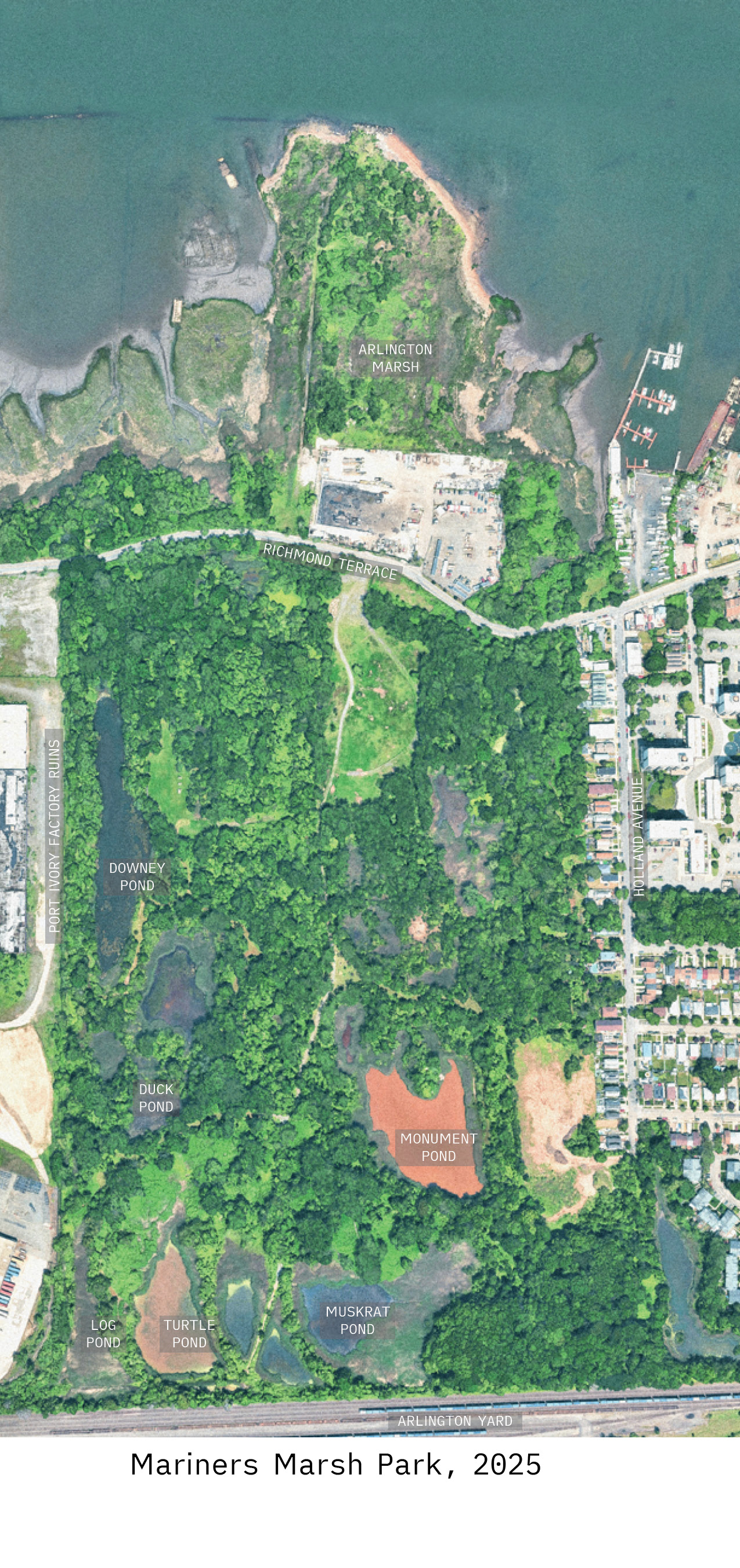
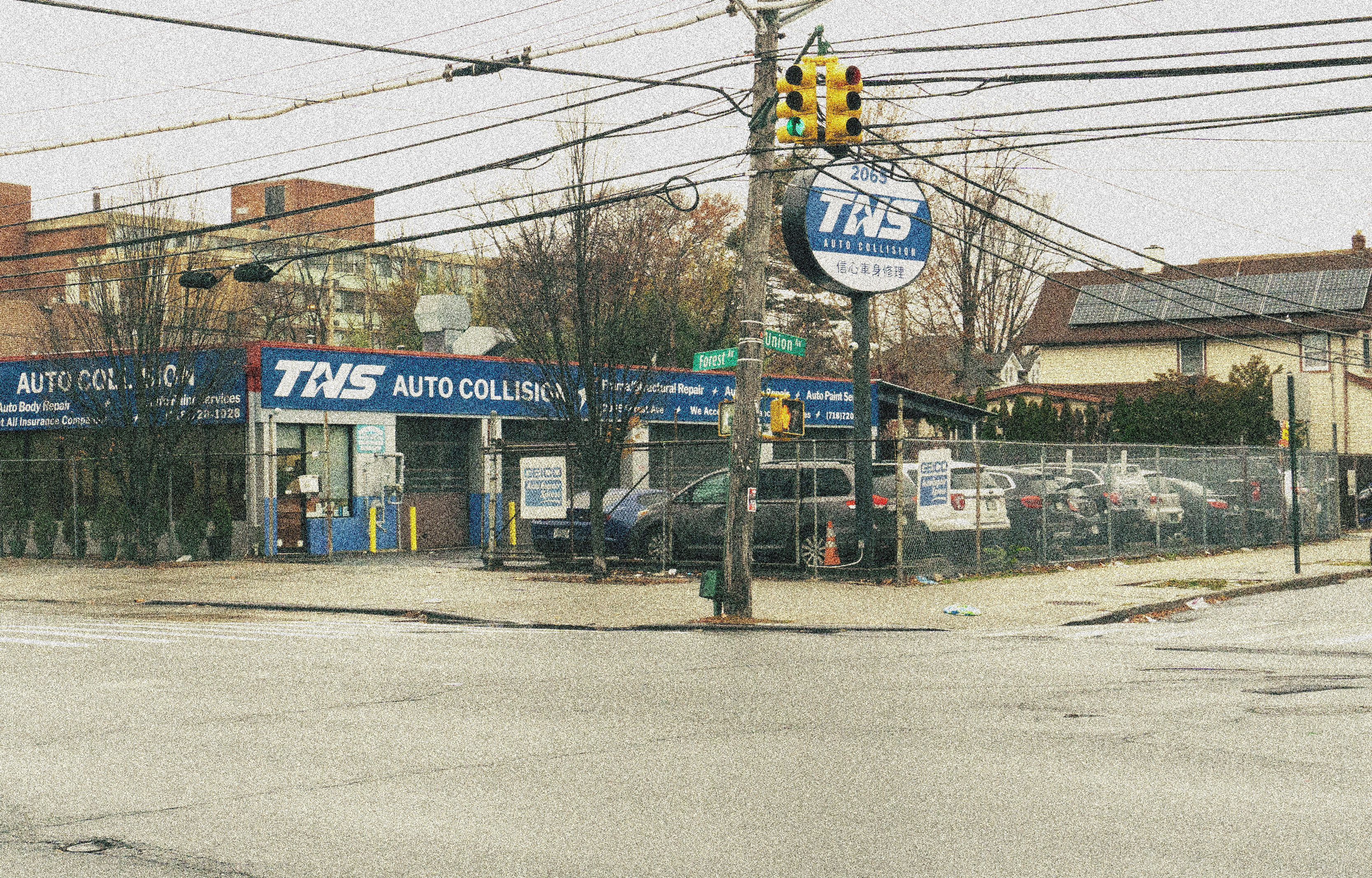 Intersection at Forest Avenue and Union Avenue (2025)
There are residential neighborhoods to the east, a large container terminal to the west, the Kill van Kull coast to the north, and more woodlands and houses in the south.
The park is an example of a recurring condition on the island, we're left on the street, surrounded on both sides by fences with no idea what lays beyond. These boundaries enclose nature (such as the fence at the park), or enclose us (the ring of storage facilities growing along the coast), leading to the question if this is how we want to experience our city. These "simple fences" are fraught with the age-old recurring conflict of man vs. nature, just on different scales.
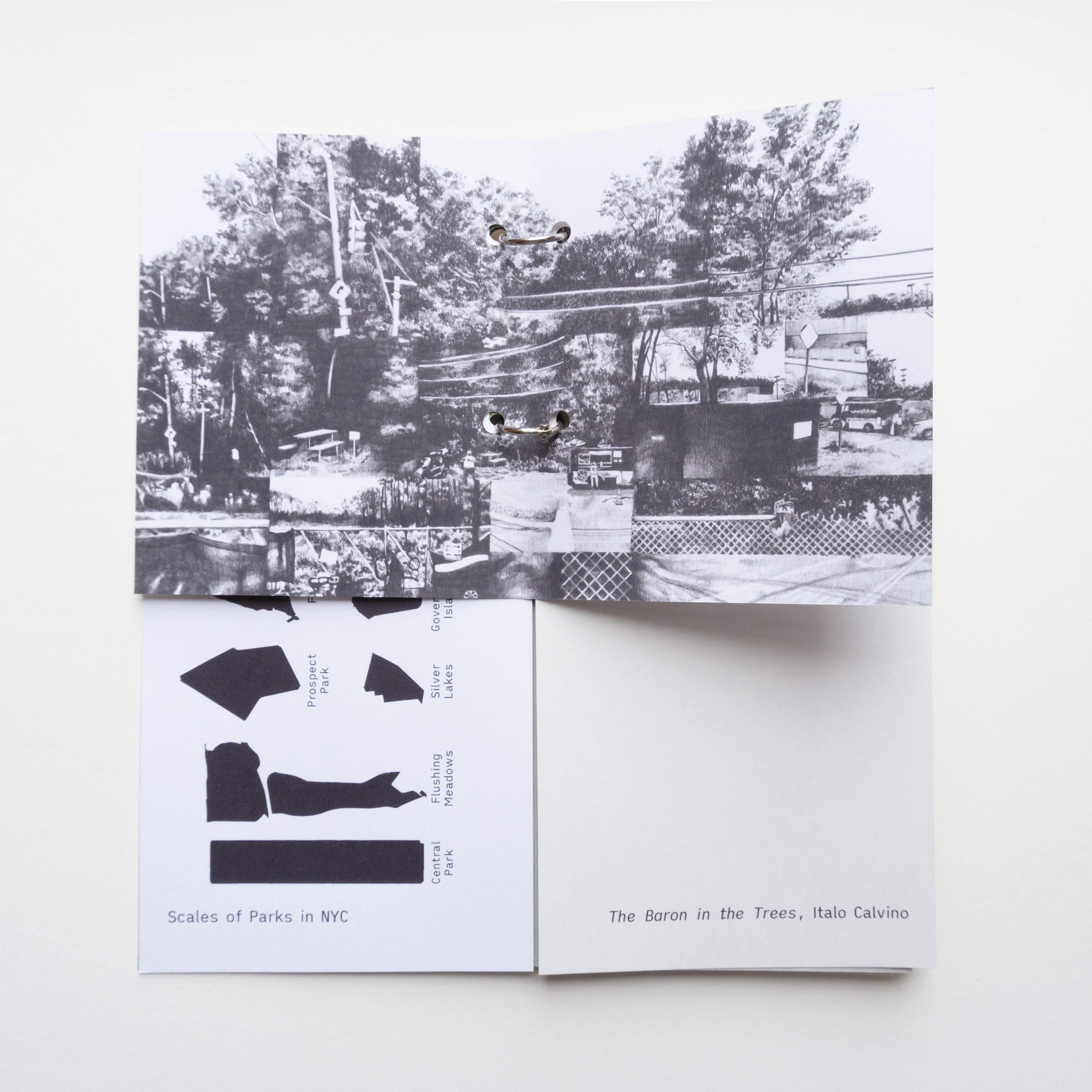
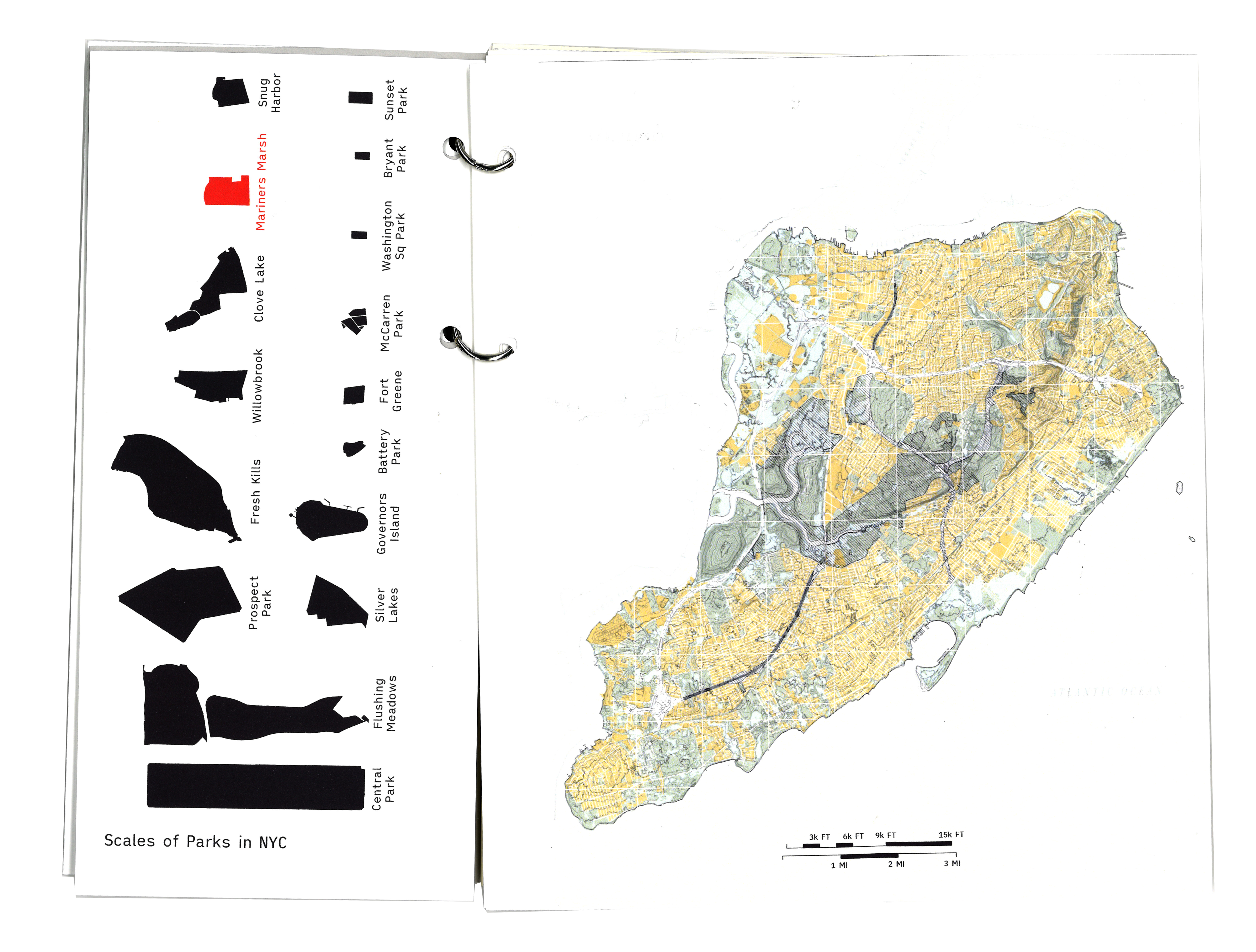 (Left) Scale comparison of Mariners Marsh Park against other NYC Parks.
(Right) Man (Yellow) vs. Nature (Green), in other words, Built vs. Unbuilt
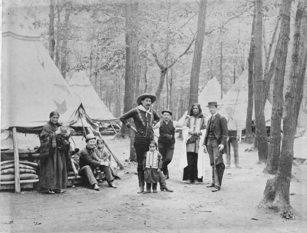
Buffalo Bill Wild West Co.
Taken at Erastina Staten Island. July 1888. Chas. H. Gallagher.
McCracken Research Library, Buffalo Bill Center of the West
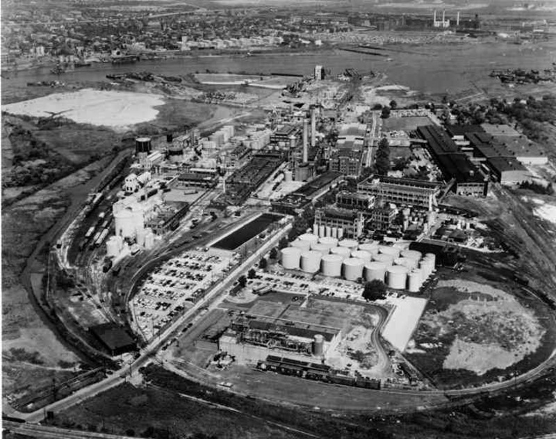 The Proctor & Gamble plant was bustling in the 1950s (1961)
Photo and caption by The Staten Island Advance
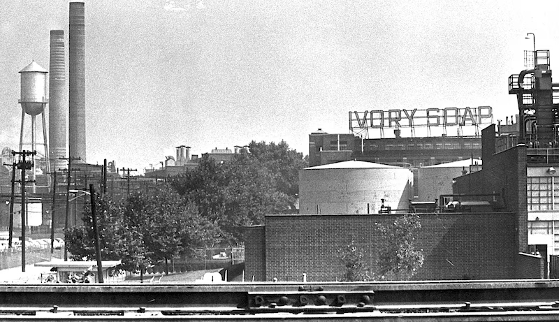 The iconic Ivory Soap sign. The smell always preceded the company’s large smokestack and power plant. Both were demolished in 2002 to make way for an expansion of the New York Container Terminal.
Photo and caption by The Staten Island Advance
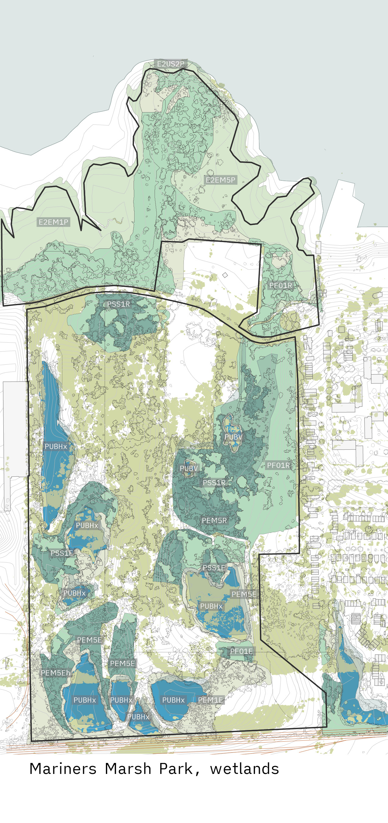
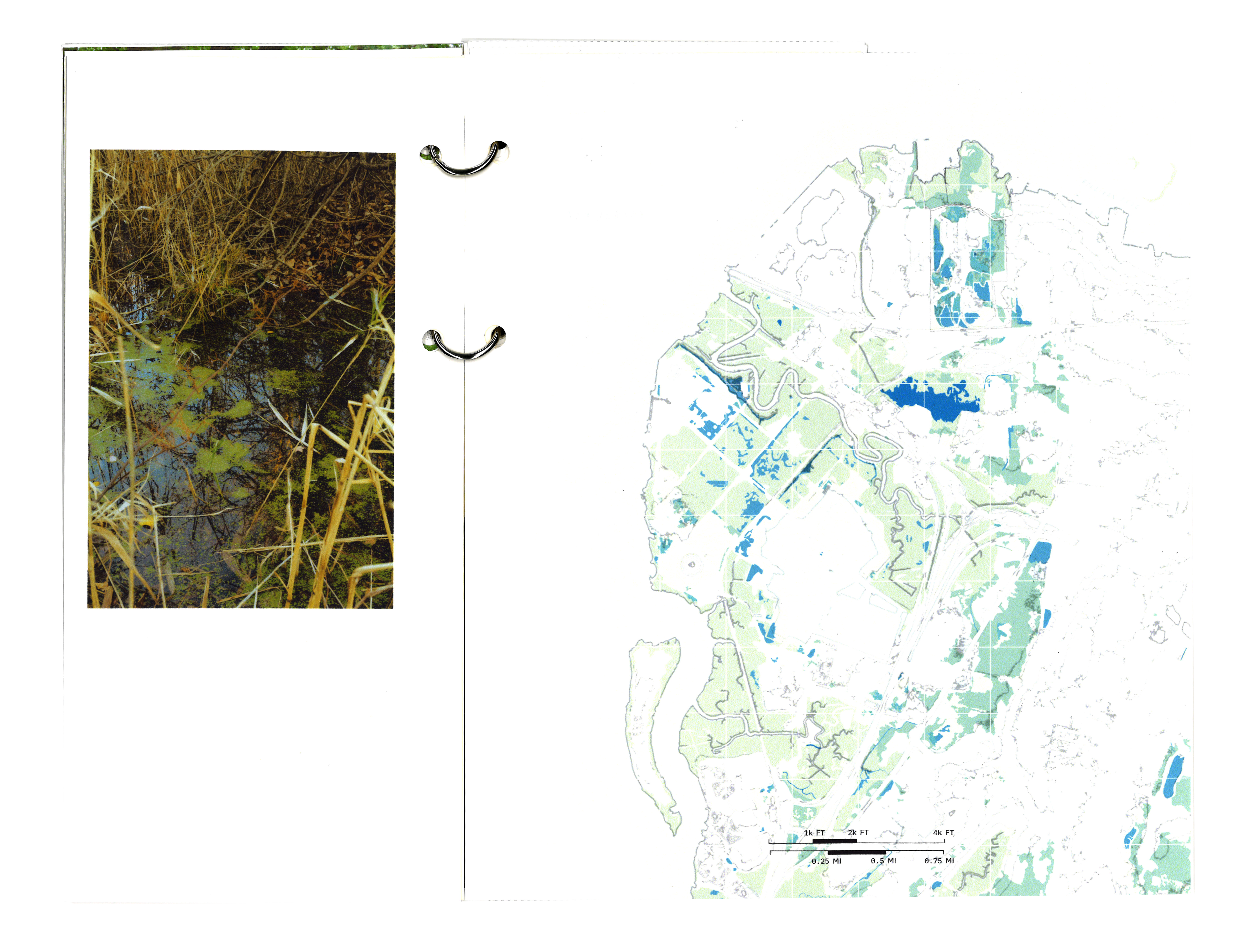 Map of the Northwest Shore's variety of wetlands
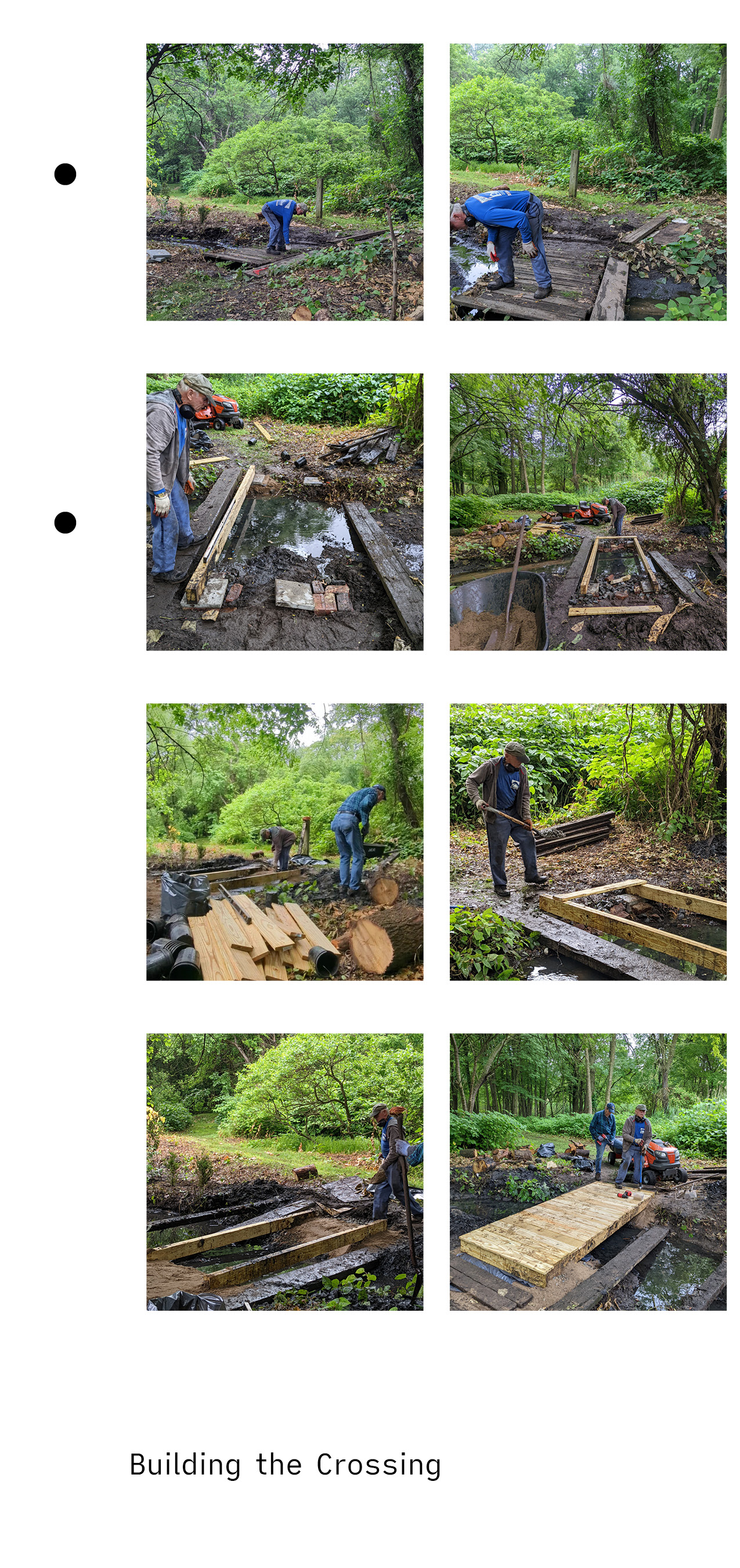
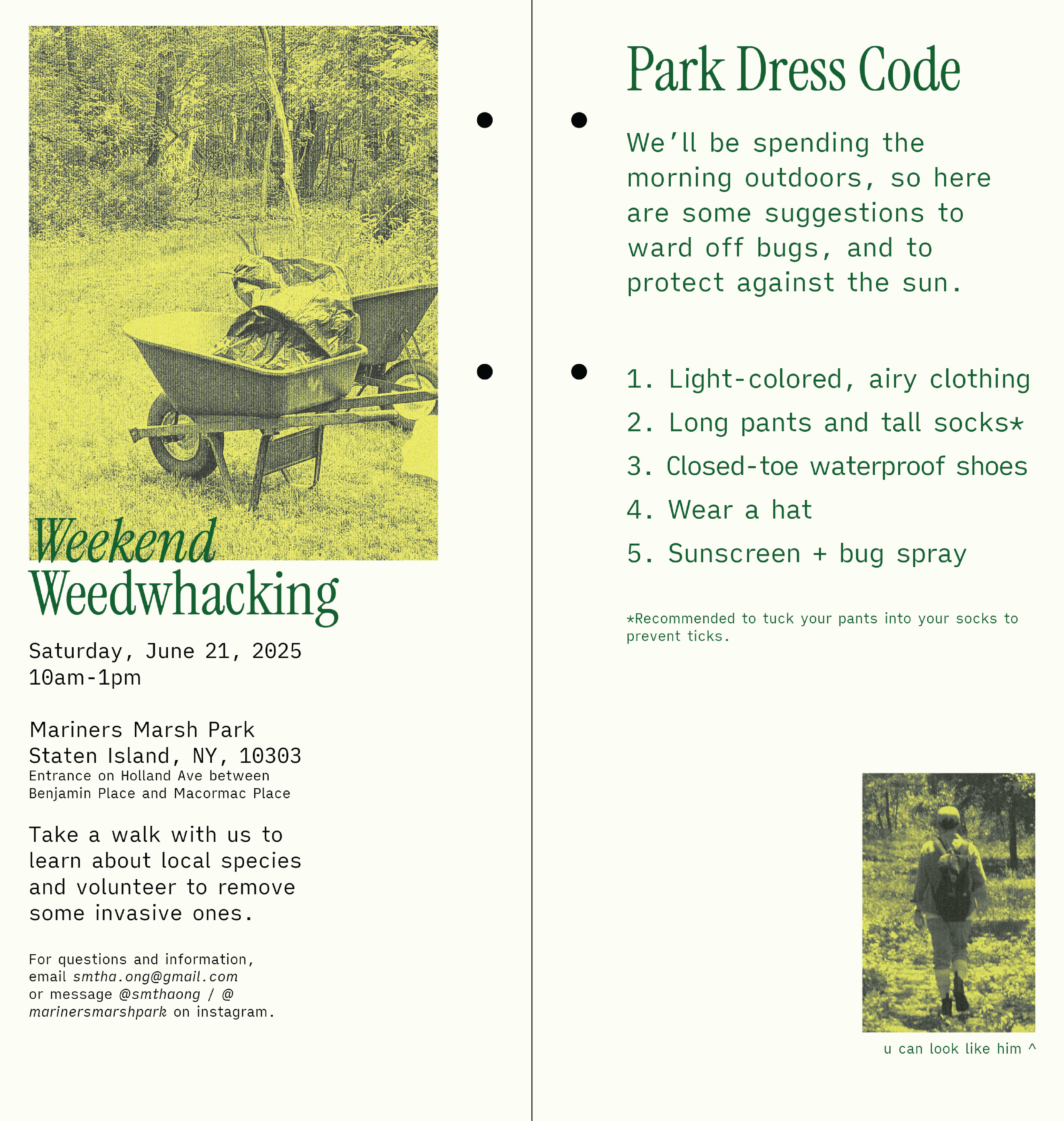
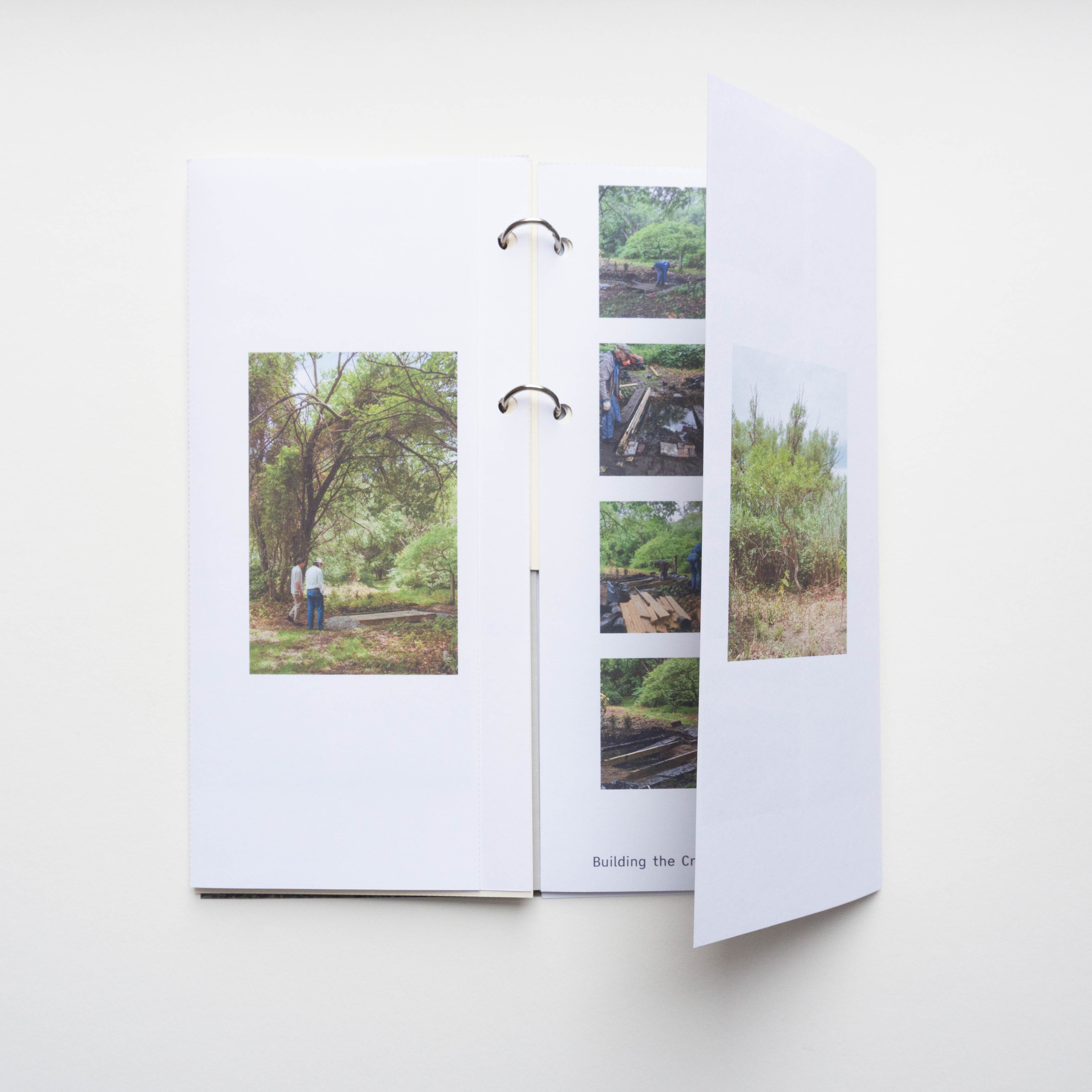
You wait all these months for the weather to warm, the park to defrost, and when 11:30a hits, you can’t find the entrance, you’re late, disoriented, and a little sweaty. You finally pass through the gate, looking for the man of the hour, while rehearsing all the possible excuses for why you’re late, and when you see him at last—moving bags of soil, sweaty, and a little grumpy—you’re too shy and embarrassed to say anything you internally practiced and confess you were lost on the complete other side of the 107 acre park.
He repeats the obvious, “You’re late,” and you begin the walk through Mariners Marsh Park.

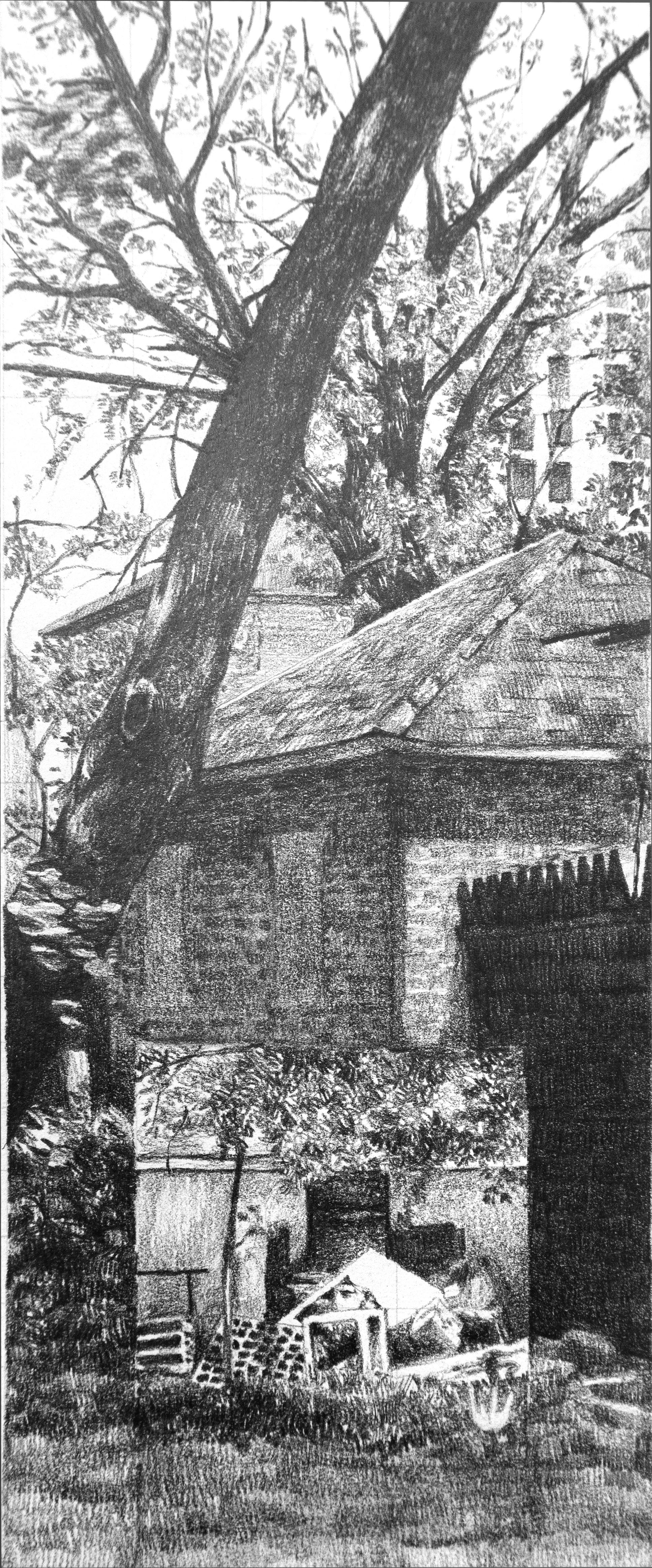
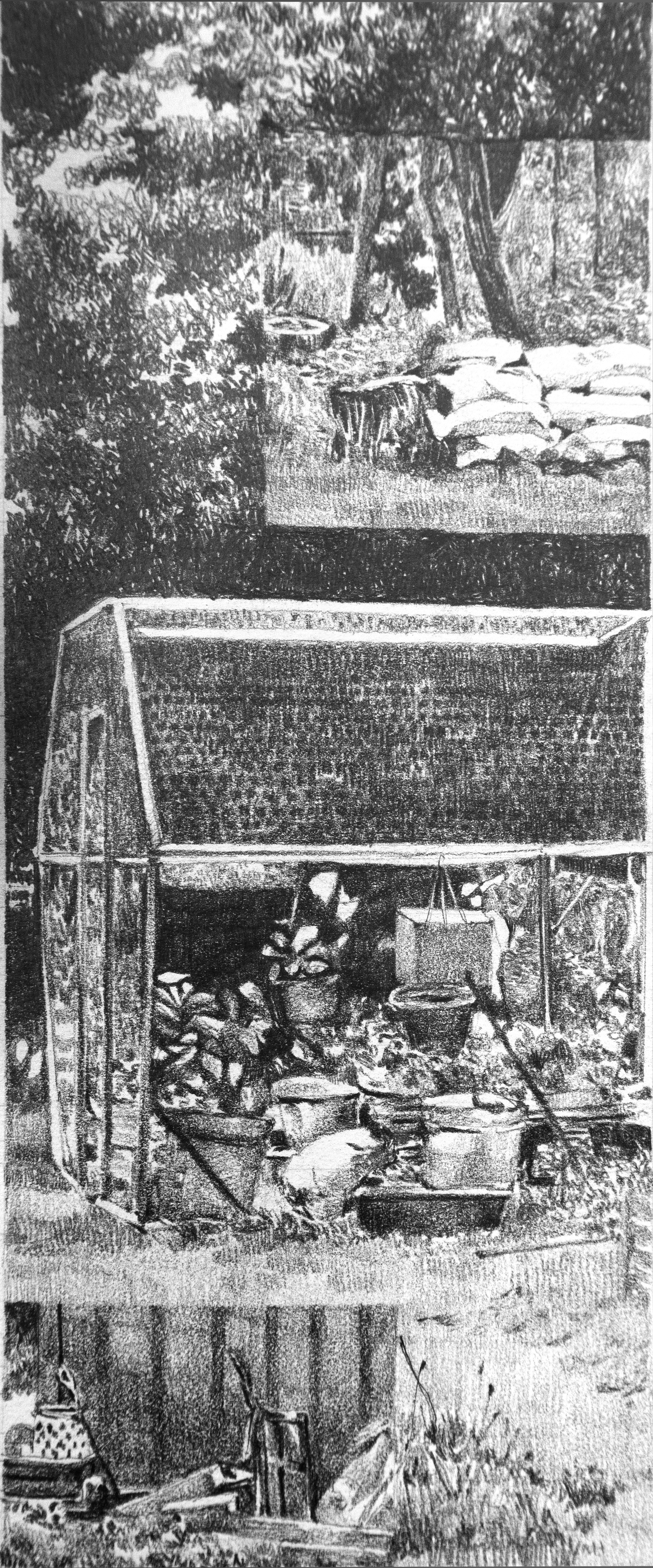
By drawing our boundaries, including what is on either side, and lastly interpreting what happens at the intersection, these sections tell the story of our relationship and experience with our land.
INTERSECTION I
 Compilation of all the panels from INTERSECTIONS I and II
INTERSECTION II

if you’re interested in having a physical copy of the field guide, or prints of the drawing
please visit: shop
if you have any questions about the project, please feel free to reach out:
smtha.ong@gmail.com
or dm on ig @smthaong
Sources
Mariners Marsh Park Archives
Brock Stax, a local resident’s historical research on the neighborhood
https://www.brockstax123aol.com/projects
Federal Register, AMNY inventory completion on archaeological Artifacts found in the park
https://www.federalregister.gov/documents/2018/08/10/2018-17217/notice-of-inventory-completion-american-museum-of-natural-history-new-york-ny#p-12
Fresh Kills Park, Robert Moses’s Design Proposal for Fresh Kills
https://freshkillspark.org/blog/robert-moses-on-fresh-kills
iNaturalist, Mariners Marsh Park Checklist
https://www.inaturalist.org/check_lists/998366-Mariners-Marsh-Park-Check-List?page=1
Library of Congress, Archive of Staten Island’s Sanborn maps
https://www.loc.gov/resource/g3804rm.g3804rm_g06213195001/?st=gallery The Neighborhoods,
Rob Stephenson’s Substacks on NYC neighborhoods
https://theneighborhoods.substack.com/p/mariners-harbor-staten-island N
ew York State Archives, The Department of Transportation’s archive of aerial photos from 1930s to 2000
https://www.archives.nysed.gov/research/res_tips_008_cscic_aerial.shtml
New York City Parks, Mariners Marsh Park
https://www.nycgovparks.org/about/history/historical-signs/listings?id=115
Staten Island Advance, “Mariners Harbor is Steeped in Maritime History”
https://www.silive.com/galleries/DSPGQSZFINEWNGBEYODHNINIPY/
United States Environmental Protection Agency - Types of Wetlands
https://www.epa.gov/sites/default/files/2021-01/documents/types_of_wetlands.pdf
Wetlands of Staten Island, Brochure from 2000
https://www.nawm.org/wetlandsonestop/staten_island_brochure.pdf
Wetlands Overview
Carson, Rachel. Silent Spring. Boston: Houghton Mifflin, 2012 (orig. 1962)
Koning, Catherine Owen. Wading Right In: Discovering the Nature of Wetlands. Chicago/London: The University of Chicago Press. 2019.
Mitsch, William J. , Gosselink, James G. Wetlands, 5th Edition. New Jersey: Wiley. 2015.
Niering, William A.Wetlands. New York: Knopf. 1985
Proulx, Annie. Fen, Bog & Swamp: A Short History of Peatland Destruction and Its Role in the Climate Crisis. New York: Scribner. 2022
Scott, James C. In Praise of Floods. New Haven: Yale University Press. 2025
Struzik, Edwards. Swamplands: Tundra, Bevers, Quaking Bogs, and the Improbable World of Peat. Washington DC: Island Press. 2021
Thoreau, Henry D. “Walking.” 1862.
Bayles, Richard M. History of Richmond County (Staten Island), New York: From its Discovery to the Present Time. L.E. Preston. 1887.
Mapping Resources
Earth Explorer
https://earthexplorer.usgs.gov/
Landsatlook
https://landsatlook.usgs.gov/explore
Old Maps Online
https://www.oldmapsonline.org/en#position=3/40.71/-74.01
Open Historical Map https://www.openhistoricalmap.org/way/198421786#map=16/40.64120/-74.17045&layers=O&date=1925-02-22&daterange=1825-01-01,2025-12-31
The National Geologic Map Database
https://ngmdb.usgs.gov/topoview/viewer/#12/40.5854/-74.1863
New York Public Library Property Map Collections
https://libguides.nypl.org/NYCpropertymaps/StatenIsland
New York City Open Data
https://opendata.cityofnewyork.us/
https://data.cityofnewyork.us/City-Government/Building-Footprints-Map-/3g6p-4u5s
New York City Buildings
https://www.nyc.gov/site/buildings/codes/nys-dec-wetlands.page
New York City’s Zoning and Land Use Map
https://zola.planning.nyc.gov/about?layer-groups=%5B%22commercial-overlays%22%2C%22street-centerlines%22%2C%22zoning-districts%22%5D#10.64/40.613/-74.059
US Fish & Wildlife Service, Wetlands Mapper.
https://www.fws.gov/program/national-wetlands-inventory/wetlands-mapper